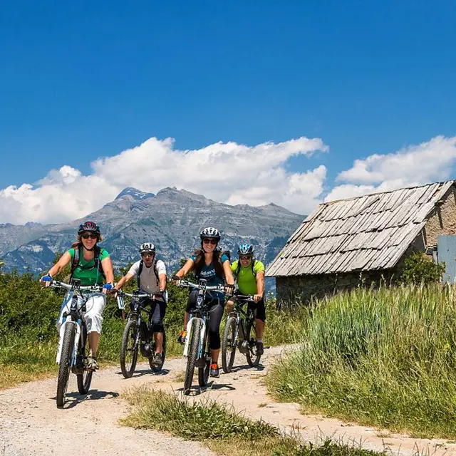
img-name-mising

Tour of Champsaur by mountain bike - 5 days

in Ancelle
246.5 km
One-way
  • Split into five stages, this route offers a refreshing change of scenery on a loop of approximately 150 kilometres and introduces you gently to a Hautes-Alpes area that is full of character.

  • This long loop introduces you to the essential features of Champsaur, a protected sector in the south of Les Écrins. Five days of immersion in this mountain valley of Mediterranean influence, with varied - and in particular sunny - landscapes awaiting the mountain biker. On this journey, you might come across the orange lily as well as true lavender! Grandiose panoramas over the valley and Les Écrins are guaranteed, an utter pleasure!
  • Tips
    A trail to be undertaken in autumn (ambiance and colours) rather than spring as the technical stretches are more cyclable after the summer season.
    Be sure to train thoroughly before embarking on five days of alpine mountain biking!

    Herd protection dogs : In mountain pastures, protection dogs are there to protect the herds from predators (wolves, etc.).When I hike I adapt my behavior by going around the herd and pausing for the dog to identify me.Find out more about the actions to adopt with the article "Protection dogs: a context and actions to adopt".Tell us about your meeting by answering this survey.
  • Departure
    Ancelle
  • Difference in height
    8272.63 m
  • Departure : Ancelle.
    Arrival : Ancelle.
    Road access : From Gap, first take the N85 and then the D944 and finally the D13.
    From Grenoble, after St-Bonnet take the D114 and the D514..
    Parking recommended : Car park at the Ancelle resort .
    Public transport : SNCF train stations at Gap or Grenoble, then daily coaches. .
  • Documentation
    GPX / KML files allow you to export the trail of your hike to your GPS (or other navigation tool)
8273 meters of difference in height
  • Maximum altitude : 1991 m
  • Minimum altitude : 852 m
  • Total positive elevation : 8273 m
  • Total negative elevation : -8255 m
  • Max positive elevation : 761 m
  • Min positive elevation : -476 m